
Khoromos—a forgotten Armenian monastery on the border plateau of Eastern Anatolia
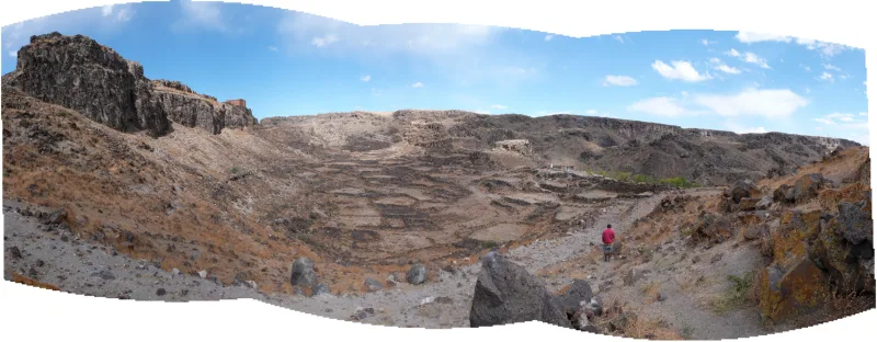
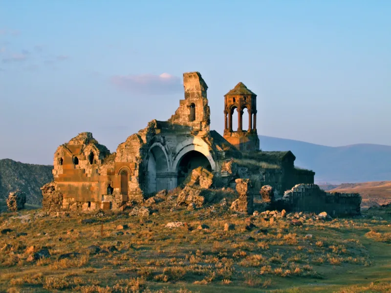
Fifteen kilometers northeast of the ruins of ancient Ani, on the right bank of the Akhurian River, stands one of Turkey’s most mysterious Christian monuments—Horomos (Horomos Manastırı). It was once the largest spiritual center of medieval Armenia and the “Armenian Saint-Denis,” where the kings of the Bagratid dynasty were buried. Today, Horomos is a semi-ruined complex of churches, mausoleums, and chapels from the 10th to 13th centuries, situated directly within a closed border zone. Massive tuff walls, carved khachkars, and the remains of a gavit—a structure that first appeared in Armenian architecture right here—tell a millennia-old story that is hard to hear even in the complete silence of the Kars wind. In its time, the monastery was one of the largest spiritual centers of the entire Christian East and rivaled the monasteries of the Holy Land in influence, and Horomos was known from Constantinople to Jerusalem.
History and Origins of Khoromos
The monastery was founded around 931–936 by a group of Armenian monks during the reign of Abas I Bagratuni. Initially, it was conceived as a modest abode, but by the middle of the 10th century, its significance had grown dramatically. In 961, the capital of the Kingdom of Ani was moved to Ani, and Horomos became a royal burial ground: Ashot III (953–977), Gagik I (989–1020), and the latter’s son Hovhannes-Smbat were buried here.
In 982, the monastery was plundered and burned by Muslim invaders, but the Bagratids quickly restored the complex, adding new churches and chapels. When Ani fell to the Seljuks in 1064, the fate of Horomos faded from written sources for a century. It was not until 1174 that dedicatory inscriptions reappeared, and a manuscript from the 1180s already describes it as a renowned religious and cultural center. In the 13th century, the monastery became the burial site of the feudal Zakariad family, who ruled Ani; according to legend, the archbishops of Northern Armenia also held their meetings here.
In 1211, the Akhpat Gospel—a manuscript that later found its way to the Akhpat Monastery—was created in the famous scriptorium of Khoromos. In its miniature “Entry into Jerusalem,” Jesus rides a donkey not into an abstract city, but directly through the gates of Khoromos—recognizable, with specific towers and a dome. To the Russian reader, this detail evokes the spirit of Andrei Rublev’s icons, where the biblical narrative comes to life within a familiar landscape.
After a period of neglect in the 15th–16th centuries, the monastery was revived in the 17th century. Restorations are documented in 1685, 1788, and 1868–1871. Until 1920, when the Kars region was part of the Russian Empire and later the First Republic of Armenia, the complex remained active and received pilgrims. After 1920, an irreversible decline began, and the monastery’s final abandonment was linked to the consequences of the Armenian Genocide.
The tragedy continued into the modern era. Some time after 1965, Khoromos was partially destroyed—according to researchers, as part of a policy of cultural genocide. The tomb attributed to King Ashot III, which existed at least until 1920, does not appear in any photographs today. Some structures have disappeared entirely, and most of the surviving walls have lost their facing masonry. As of 2003 and according to later researchers, the monument is located right on the Armenian-Turkish border, and obtaining permission to visit it is practically impossible.
Architecture and What to See
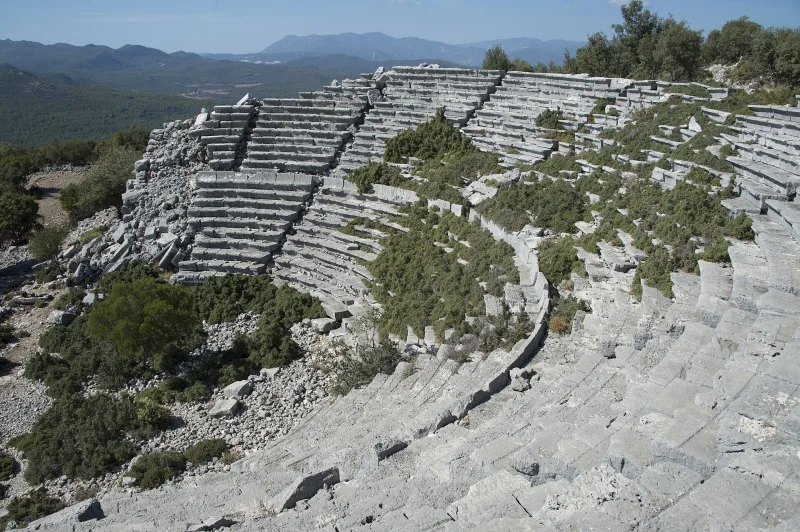
Khoromos is not a single temple, but an entire necropolis. The complex stretches across a plateau and partially down the slope toward the Akhurian River. Most of the structures are surrounded by a rectangular fortress wall, fragments of which have survived. All the main churches of Khoromos are cross-domed halls in which the supporting pillars are integrated into the walls; this type is considered the pinnacle of the Ani architectural school.
The Church of St. John and the First Gavet in Armenia
The main building of the complex is the Church of Surb Hovhannes (St. John), built in 1038 by King Hovhannes-Smbat, son of Gagik I. Today it is heavily damaged: the dome collapsed in the 1970s, and the walls have lost their facing masonry. But it is precisely this church that is associated with a world-class architectural discovery—the first jamatun (gavit) in Armenian architecture, added to the church in the same year, 1038.
The jamatun was conceived as a gathering place for the congregation before entering the sanctuary. In the dedicatory inscription, Hovhannes-Smbat donated a vineyard in Kolbe and “this jamatun” to the monastery, thereby preserving for history the exact Turkish, Armenian, and Russian names of this new architectural type. The central section of the gavita is covered by a stone dome with a skylight, while the side sections feature carved ceilings with the finest geometric patterns. It is here that the king’s tomb is located.
The Ruzukan Chapel and the Tomb of Vache Vachutyan
Adjacent to the southern wall of Surb Hovhannes is the two-story Ruzukan Chapel (1215), commissioned by Princess Kutlu-khatun in memory of her mother under the supervision of Bishop Sarkis. The main hall with three arches, four khachkars on the eastern wall, and a decorative “Seljuk braid” exemplify the dialogue between Armenian and Islamic art long before the Seljuks.
South of the gavit stands the tomb of Prince Vache Vachutyan (1229), ruler of Ani and founder of the vassal Zakhari dynasty. The 8×8-meter square room is crowned by a stone stalactite canopy—the precursor to “muarnas”—which, according to 19th-century photographs, rose nearly 9 meters high. A dedicatory inscription carved on the tympanum lists the gifts made by the monastery’s patron: silver ripides, a vineyard in Avsakhan, and payment for memorial liturgies.
The Aruich Gavet and Other Structures
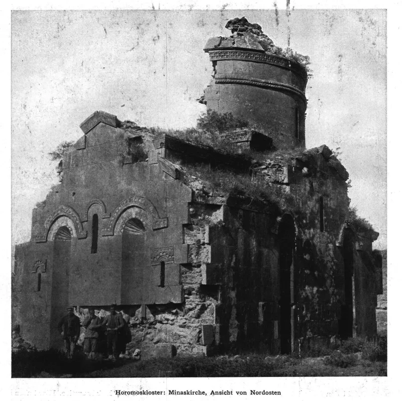
Nearby stands the Aruich gavit (1277), named after the merchant Aruich Hogeworeanc’ (Aṙwic Hogeworeanc’). Its vault rests on a pair of parallel arches converging in a dome with muqarnas and an open oculus. In style, it resembles the gavit of the Church of the Holy Apostles in Ani. On the walls is a detailed inscription describing the restoration of the aqueduct, originally built in 1198 and left in ruins after the Mongol invasions. Aruits’ inscription reads almost like a personal appeal to future generations: “In the year 726 [i.e., 1277], by God’s will, I, Aruits, son of Sarkis, and my wife Seda built this shrine with our honest earnings in memory of our parents…” To the north of the main complex, outside the walls, stand the oldest structures of Horomos: the Church of Surb Minas (before 986), Surb Gevork (after 1020), and the Chapel of King Ashot. According to researchers, this is where the monastery’s original center may have been located. A short distance away, on the road to Ani, the ruins of a triumphal arch from 1102 have survived, consisting of two four-sided towers with chapels at the top, connected by a vault.
Interesting Facts and Legends
- In 1211, the Akhpat Gospel was created in the local scriptorium. In the miniature “Entry into Jerusalem,” Christ enters through the recognizable gates of the Horomos itself—a rare instance where a medieval manuscript depicted its own monastery as the site of biblical events.
- The Surb Hovhannes Gavit of 1038 is the first documented building of this type in all of Armenian architecture. The term “jamatun” was first used in the Horomos inscription.
- In 1860, the British traveler John Asher described Horomos as a vast ruin inhabited by a single monk-caretaker. Sixty years later, even this lone inhabitant had disappeared.
- The dome of the Surb Hovhannes Church stood for nearly 930 years and collapsed only in the 1970s—practically within the memory of today’s Kars elders.
- The monastery is unofficially called the “Armenian Saint-Denis” by analogy with the Parisian abbey where the kings of France were buried: the Bagratid kings turned Horomos into their dynastic burial ground, and the tombstone of Ashot III, visible to travelers as late as 1920, was lost after 1965.
How to get there
Khoromos is located in a closed military zone right on the Armenian-Turkish border, approximately 52 km as the crow flies from the city of Kars. Independent visits to the ruins are generally impossible: a special permit is required, which is not granted to everyone and not always. The closest place you can actually visit is the Ani archaeological site, located 15 km southwest of the monastery.
It is convenient to fly to Kars from Istanbul (flights SAW and IST, about 2 hours) or take the “Eastern Express” train from Ankara. The distance from Kars to Ani is 45 km along a paved road, about an hour’s drive. During the season, dolmus minibuses run from the Kars bus station (departing in the morning, returning after lunch), and private transfers are available for 600–900 liras per person. From Ani, Horomos is visible through binoculars to the north: the rocky plateau above Akhurian and the ruins of churches are easily discernible in good weather. For a more in-depth visit, it’s worth contacting the Kars Museum or local guides specializing in Armenian heritage in advance—they’ll provide up-to-date information on entry requirements.
Tips for travelers
The best time to visit is late spring (May–June) and golden autumn (September–early October). In winter, the plateau is covered in snow and strong winds, and temperatures drop to -20 °C; in summer, in July and August, short but intense thunderstorms are possible. Even if you don’t get permission to visit Khoromos itself, a day in Ani won’t be wasted for any of these reasons: the ruins of the ancient capital of the Bagratids are one of the most impressive archaeological sites in eastern Turkey.
Bring your passport (border zone), water, a windbreaker, and sturdy shoes: even the trails leading to the overlooks above Akhurian are rocky. A telephoto lens or 10× binoculars turn viewing Khoromos from a distance into a worthwhile experience: the dome drums, the remains of the walls, and the triumphal arch from 1102 are clearly visible in the morning or evening light. Some Armenian travelers come here specifically for a single shot—the silhouette of the “Armenian Saint-Denis,” photographed from Turkish territory against the Armenian sun.
The minimum recommended time for a visit is one and a half to two hours if you are limited to the observation deck above Akhurian, and half a day if you have obtained a pass to the ruins themselves. It’s best to bring food and water with you: there are no cafes in the vicinity of Ani, and the nearest shops are only in the village of Ojakly (formerly Ojagkoy) near the southwestern gates of Ani. We recommend downloading an offline map in advance—cell service near the border is unreliable, and some carriers automatically switch to the Armenian network with roaming.
It’s worth combining your trip with a visit to the Kars Fortress, the Surb Arakelots Church (now the Kümbet Mosque), and the old Russian quarters of Kars—a reminder of the period when these lands were part of the Russian Empire. For a deeper context before your trip, read E. Markov’s essays “Russian Armenia” (1901) or F. S. Yanovich’s travel notes on the Kars region—they offer a poignant panorama of the early 20th century, when the monastery was still active. And remember: Khoromos is not just a dot on the map, but a lesson in the fragility of monuments standing at the crossroads of civilizations; it deserves the same respect we accord to Novgorod or Kizhi.